Drone Mapping
What is Drone Mapping?
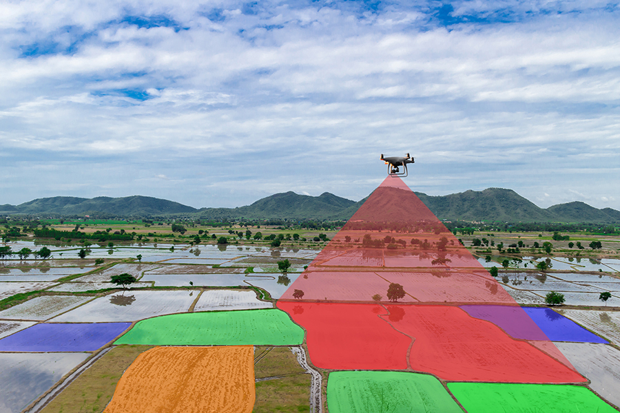
Drone mapping refers to the process of capturing aerial data using drones (also known as unmanned aerial vehicles, or UAVs) to create detailed maps and 3D models of specific areas. These maps are used in various industries such as agriculture, construction, environmental conservation, and urban planning.
How Drone Mapping Works
Drone mapping involves several key steps:
Planning: A flight plan is created for the drone to cover the area of interest. Specialized software is used to define the area, altitude, and the required overlap between photos.
Data Collection: The drone flies autonomously or manually over the predefined area and captures high-resolution images from multiple angles. Drones are equipped with cameras, LiDAR, or multispectral sensors, depending on the application.
Processing: The images and sensor data are processed using photogrammetry software to stitch them into a large, high-resolution 2D map (orthomosaic) or create 3D models (digital elevation models or point clouds).
Analysis: The resulting maps can be analyzed using GIS (Geographic Information System) software to extract valuable insights such as topographical features, vegetation health, or structural measurements.
Key Technologies in Drone Mapping
Photogrammetry: A process that converts overlapping images into 3D models by triangulating positions of common points.
LiDAR (Light Detection and Ranging): Uses laser pulses to create highly accurate 3D models, especially useful in mapping dense vegetation or forested areas.
Multispectral and Hyperspectral Sensors: Capture images in different wavelengths, useful in agriculture and environmental monitoring to assess plant health and detect changes invisible to the human eye.
Benefits of Drone Mapping
Cost-effective: More affordable compared to traditional aerial surveys using planes or satellites.
High precision: Provides highly accurate maps with centimeter-level detail.
Efficient: Faster data collection over large areas, significantly reducing time compared to ground-based surveys.
Versatile: Can be used in various fields such as agriculture, forestry, construction, mining, and disaster management.
Applications of Drone Mapping
Agriculture: Drones equipped with multispectral sensors help monitor crop health, irrigation, and yield prediction. Farmers can identify issues such as pest infestations or soil deficiencies early.
Construction & Surveying: Site managers use drone maps to monitor progress, calculate material volumes, and track changes over time. This helps streamline project management and reporting.
Environmental Conservation: Drone mapping aids in tracking wildlife, forest monitoring, and land management efforts by providing real-time data.
Mining & Quarrying: Accurate 3D terrain models assist in tracking resources, planning extractions, and ensuring safety in operations.
Urban Planning: Drones help create accurate maps for city planning, infrastructure development, and road construction projects.
Disaster Response: After natural disasters like floods or earthquakes, drones can quickly map affected areas to assist in recovery efforts and damage assessments.
Challenges in Drone Mapping
Regulatory Constraints: Many countries have strict regulations regarding drone flights, especially in urban or restricted areas.
Weather Dependency: Drones are sensitive to weather conditions such as strong winds, rain, and fog, which can affect data collection.
Battery Life: Limited flight time means large areas may require multiple flights to cover.
Future of Drone Mapping
The future of drone mapping is promising, with advancements in AI, machine learning, and autonomous drones set to revolutionize the field. These technologies will make mapping faster, more accurate, and applicable to even broader areas such as underwater mapping or Mars exploration.
Popular Drone Mapping Software
Pix4D: A leading photogrammetry software that turns drone images into detailed maps and 3D models.
DroneDeploy: A cloud-based platform offering real-time mapping and 3D modeling for various industries.
Agisoft Metashape: Known for processing drone images into georeferenced 2D maps and 3D models.
Global Mapper: A GIS software that integrates drone data with traditional GIS workflows for advanced analysis.
For inquiries or a detailed consultation on drone mapping, feel free to reach out.